B&W Solutions
No two communities are alike and Baxter & Woodman’s Spatial Technology team understands that data management is not a one-size fits all. Whether a community is equipped with a Geographic Information System (GIS) or not, our team uses the power of Esri ArcGIS Tools to manage a variety of information for each water service line, streamlining each key step in your Lead Service Line Replacement Program:
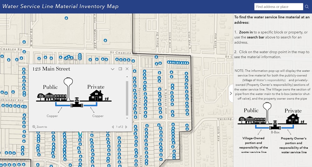
- Water Service Line Material Inventory
- Public Water Service Material Web-Map
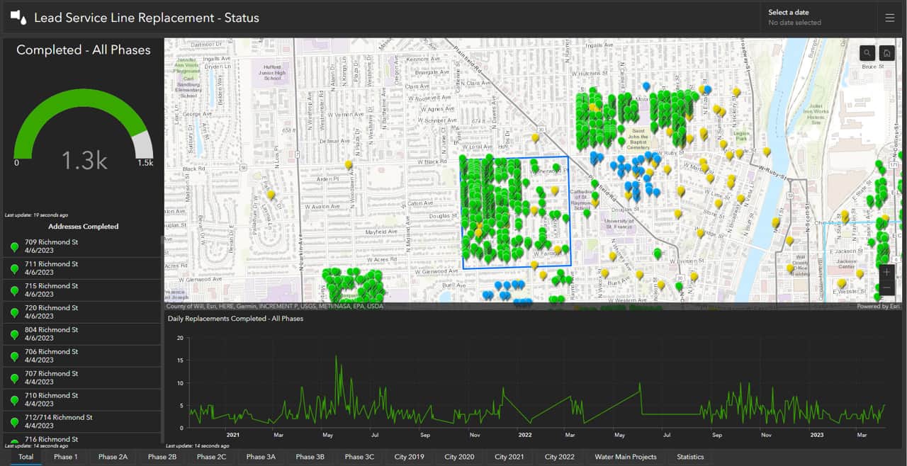
- Lead Service Line Replacement Plans (mapping requirements)
- Public Notification Tracking
- Lead Service Line Replacements & Required Construction Documentation
For communities that are not equipped with GIS, we will always make sure that we format your data in a way that is most suitable for you and your staff to use.